The Countryside
The beautiful region around Mont Saint-Michel seems decidedly turned towards the sea ... But do not be fooled! The interior of the land will surprise you with its rich natural heritage.
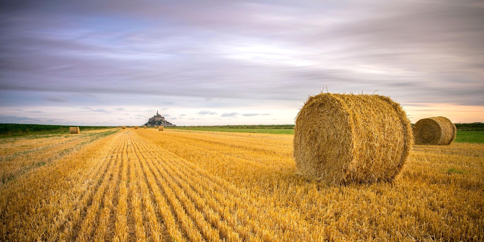
 It is indeed a land of contrasts and varied and local landscapes such as the legendary peat bogs, wetlands that are formidable reservoirs of life to the unique ecosystem, or the famous Norman grove through the polders, these lands claimed by man from the sea.
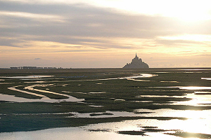
Close to the "Bruyères du Mont", on the other side of the estuary, the Gué de l'Épine at the mouth of the Sée is a beautiful natural area where sheep graze in the salt meadows. You have a breathtaking view of the bay, Mont Saint-Michel and Tombelaine.
A little further up the coast, Pointe du Groin du Sud is a natural lookout, a wild and unspoilt site from where you can enjoy a remarkable view of the bay and Mont Saint-Michel. The place is also ideal to admire the spectacle of the tides.
 Continue to head north ... We will find the cliffs of Carolles and Champeaux that close the bay of Mont Saint-Michel to the northeast. At Carolles, the Lude sliced the granite like a sword. It seems so extraordinary that such a small stream has dug a rock so hard, that popular legend has attributed this cut to the sword of the Archangel Saint-Michel who delivered here a fight with the Devil entrenched on the Sard Rock, also called the Devil's Chair.
The height of this granite massif allow the view to embrace a remarkable panorama of the Bay of Mont Saint-Michel. At the top of the cliffs, you can take the pedestrian coastal path which meanders through wild vegetation, dense and varied among gorse, broom and heather. General Eisenhower would have said, and Edouard Herriot before him: "I am here on the most beautiful kilometer of France! "
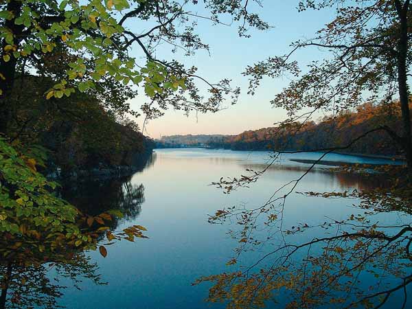
But let's take a moment out of the bay ... In the south-west, the Ardennes forest on the banks of the Selune, its oak and beech woods and its coppice of birches invite you to stroll, to relax and enjoy with its hiking trails and picnic areas, its sports course, and a discovery course of Sélune that offers a playful awakening to nature.
 Push a little to the east, and you are in the Mortainais and its preserved green and fresh countryside, hiking land with many marked trails, bordering the Normandy-Maine Regional Nature Park. Do not miss the waterfalls of Mortain, two spectacular waterfalls: the big waterfall where the waters of the Cance leap between two walls of rocks before making an impressive fall of 25 meters, and the small waterfall, shaded and easy site of access that lends itself to family walks.
A little further up reveals the valley of the Sée, also called valley with 100 mills, and its hilly and wooded landscapes. If you take the time to linger, you will discover there a little less known area of Normandy east of Mont Saint-Michel, a high country of hills full of charming villages and green landscapes of Normandy.
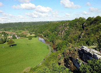
To the north-east, the rocks of Ham south of Saint-Lô form a vertiginous wall, a wall of shale culminating at 105 meters above the Vire. Come sample the beauties of nature in the beautiful surrounding landscapes: hedgerow, river, meadow plots, caves, meadows and streams ... Beautiful walks in perspective!
And to discover this magnificent heritage, it is not the hiking trails that are missing. It's impossible to name them all here, but we can mention the best known, including:
- The paths of Mont Saint-Michel, several itineraries that accumulate thousands of kilometers marked out on the ancient routes of the pilgrims;
- The famous GR 22, which takes you in the footsteps of the Miquelots (pilgrims of Mont Saint-Michel) on a route from Notre-Dame de Paris to Mont Saint-Michel;
- Veloscenes and its 450 km of cycle paths, greenways and small marked roads, from Notre-Dame de Paris to Mont Saint-Michel;
- The Tour de Manche, a Franco-British loop linking Normandy to the south-west of England, passing through the north of Brittany;
- The Ragmen's Road which connects the coastline of Saint-Pair sur Mer to the Sée Valley through landscapes of grove, undergrowth and valleys. These roads were formerly used by the ragpickers to convey waterfalls and fabrics from the ports to the mills of the Sée Valley.
- And finally, the GR 223 or "Douaniers trail" which crosses the Normandy coast, from Carentan to Mont Saint-Michel through Cherbourg to the north, before descending on Coutainville, Granville, the cliffs of Champeaux, the dunes Dr blondes
 Dans la baie du Mont Saint-Michel et en Normandie, terre gastronomique, le voyage et les découvertes sont aussi culinaires ! On connaît bien sûr la fameuse omelette de la Mère Poulard, la spécialité du Mont Saint-Michel, l’agneau de pré-salé avec sa saveur inimitable qui ravira les gourmets, ou encore l’andouille de Vire à la saveur authentique.
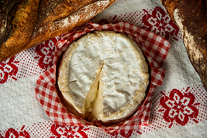
Emblème vivant de la Normandie, la vache normande et son bon lait sauront vous régaler : venez déguster les fromages normands avec en tête le trio camembert, livarot et pont-l’évêque, la crème onctueuse et le beurre d’Isigny qui accompagnent les repas de viandes, coquillages et poissons.
Bien sûr, les plats de poissons et fruits de mer sont aussi à l’honneur : poissons plats, lisettes, huîtres du Cotentin, moules de bouchot, coquilles Saint-Jacques et pétoncles…

Our guide "1001 treasures" (more)...
In order to discover ALL tourist activities and visits to our beautiful region, Les Bruyères du Mont invites you to read the OTHER pages "tourism" below ...
| Your desires | Your destinations |
|
Photos credits :
Mont-Saint-Michel : Wikipédia
Bocage Normand et Ham Rock : Manche Tourisme
Norman cheese : Maxpixel

Authentique

Confortable

Unique

Convivial

Paisible